
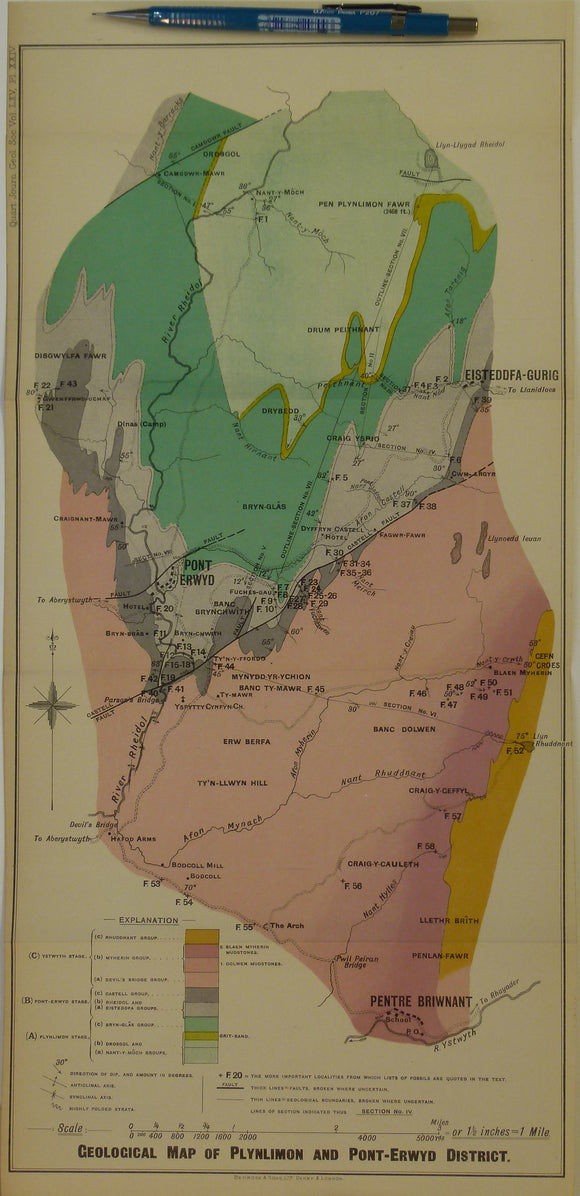
Wales Mid- 1909. Geological Map of Plynlimon and Pont-Erwyd District, colour
Wales Mid- 1909. Geological Map of Plynlimon and Pont-Erwyd District, colour printed folded map at 1:42,240 (1.5 ins =1mile) 44 x 22cm, in ‘The Hartfell-Valentian Succession in the District around Plynlimon and Pont-Erwyd (North Cardiganshire)’ extract from Quarterly Journal of the Geological Society, v.65. 1909. By Owen Thomas Jones. Pp.463-537. Map and text in very good condition.