
De Geer, G. 1911. Scandian Subsidence area with centres of uplift. Colour printed folded map
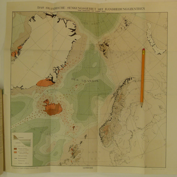
De Geer, G. 1911. Das Skandische Senkungsgebiet mit Randhebebungszentren. Colour printed folded map (41.5 x 33cm) at 1:800,000 (translates approx. as the Scandian Subsidence area with centres of uplift) with ‘Kontinentale Niveauveranderrungen im Norden Europas, (Continental level changes in Northern Europe)
an offprint of the Proceedings of the 11th International Geological Congress, Stockholm, 1912, pp849-860. In German. The text is clean, slightly age-toned with library stamps to cover and title page, otherwise in very good condition. The map is clean and bright and in very good condition.