
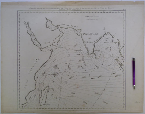


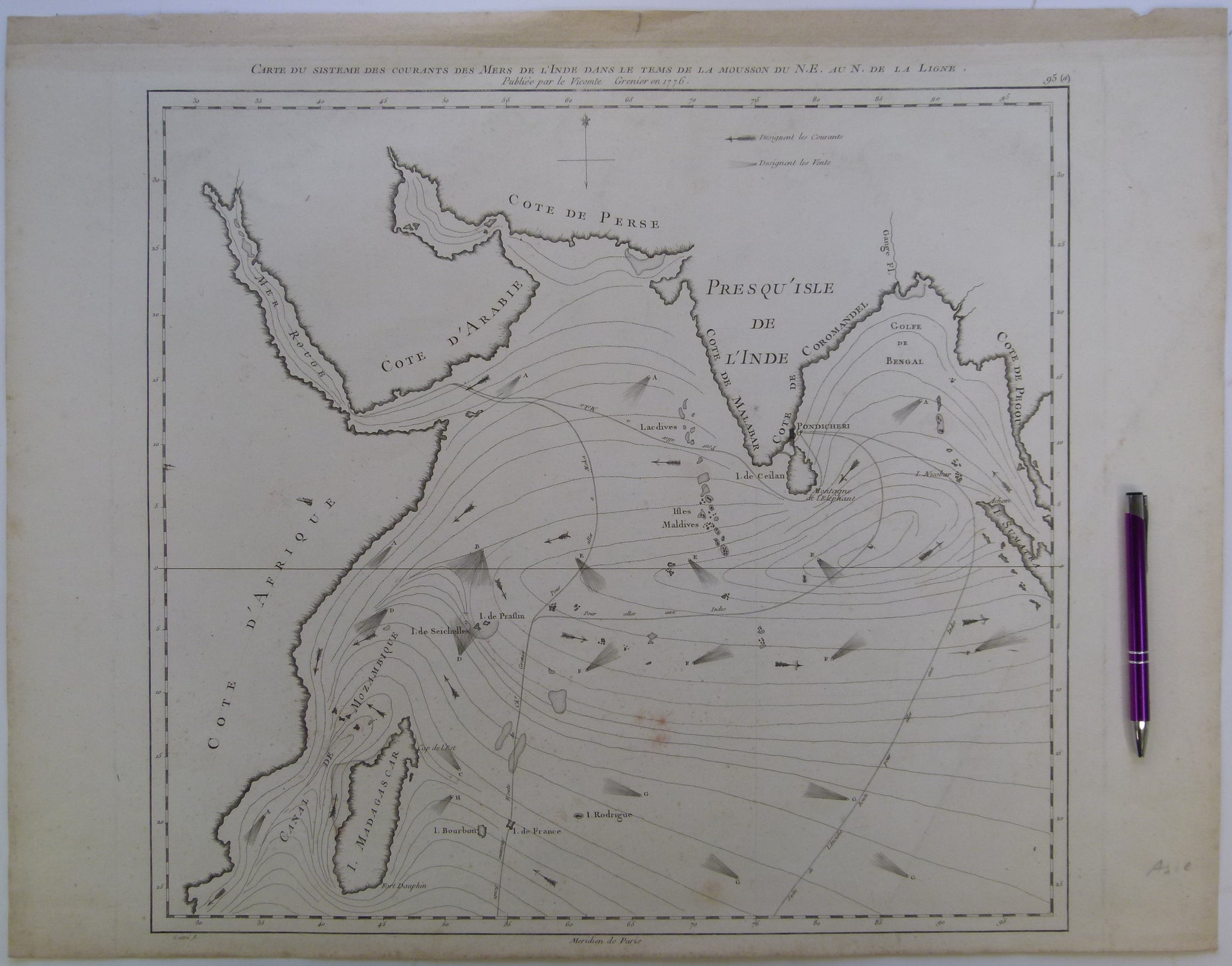
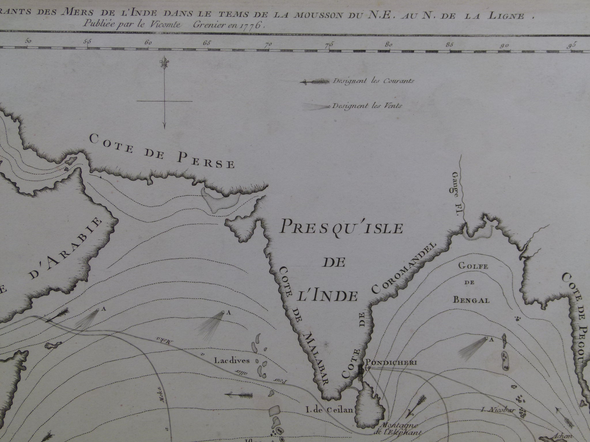
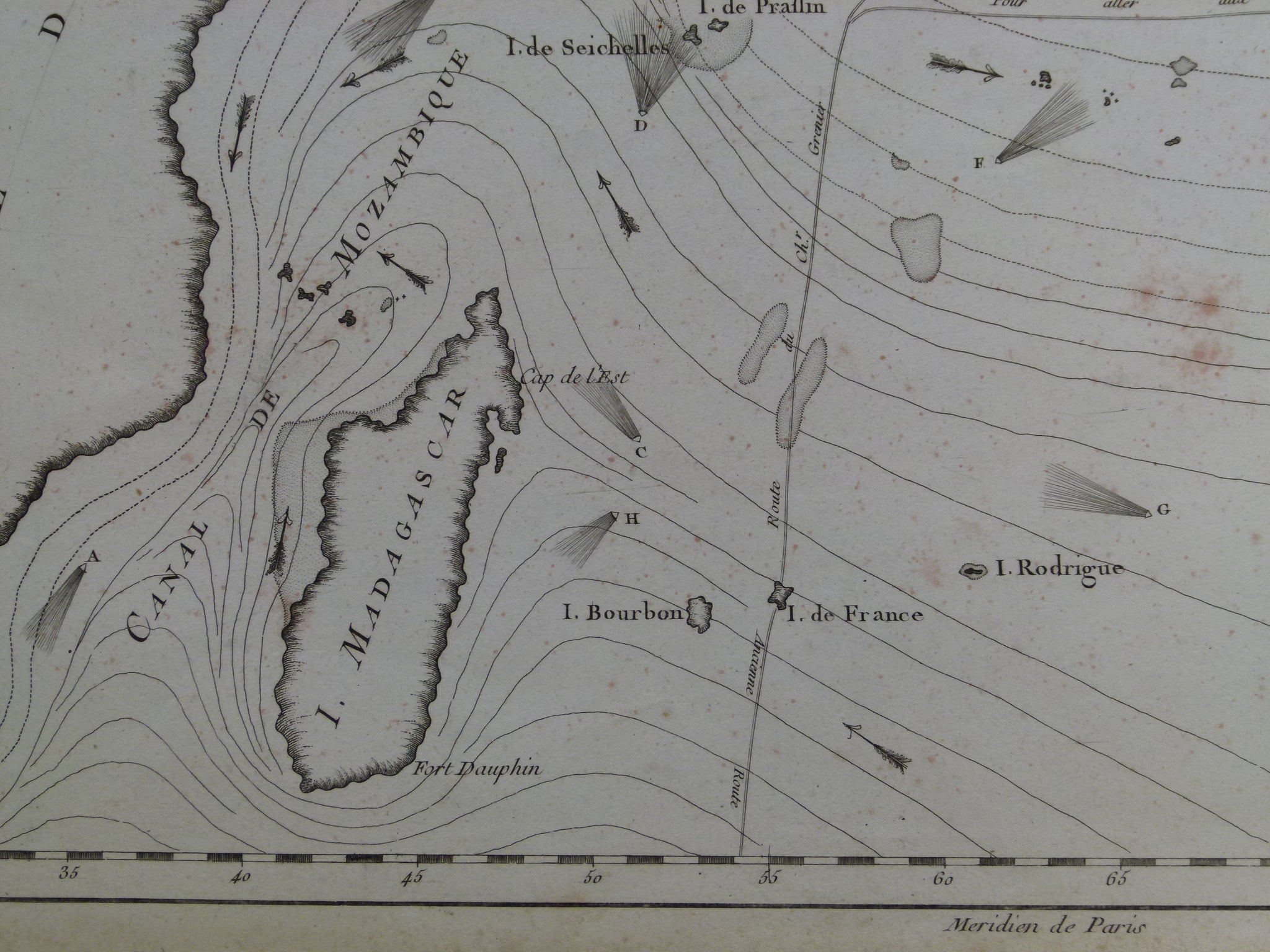
Indian Ocean. Grenier, Jacques-Raymond de (1776). Carte du Sisteme des Courantes des Mers de l’Inde dans le Tems de la Mousson du NE au N. de la Ligne. Paris: Lattré.
Indian Ocean. Grenier, Jacques-Raymond de (1776). Carte du Sisteme des Courantes des Mers de l’Inde dans le Tems de la Mousson du NE au N. de la Ligne. Paris: Lattré. [A Chart of the System of Currents in the Indian Ocean during the Time of the Northeast Monsoon to the North of the Equator] Engraved uncoloured print. Approx. scale 1:15,000,000. 49 x 63cm. Undated phoenix-like watermark. Age-toned, clean, but faint reddish rubbing in mid ocean and on back, perhaps, from past folder. Residue of tape on back from past hanging strip. Trimmed with plate mark on bottom edge, minor marginal tears on top edge. In good condition. NOT GEOLOGICAL
A great monument of enlightenment era thematic cartography. Rare. Shows sailing routes between the Straits of Malacca and Indian ports and the Cape of Good Hope across the Indian Ocean that took advantage of or avoided seasonal winds. De Grenier (1736-1803) personally discovered and mapped these new, dramatically faster sailing routes during several expeditions in the 1760s and '70s.