
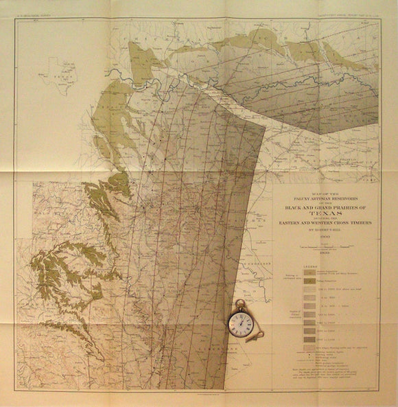
Map of the Paluxy (formation) Artesian Reservoirs of the Black and Grand Prairies of Texas, 1900
Map of the Paluxy (formation) Artesian Reservoirs of the Black and Grand Prairies of Texas, 1900. By Robert Hall, Plate 70 of USGS 21st annual report. Scale 1"=10miles. Folded colour print 32"x30". Very well balanced cartographic design incorporating grey, brown, and green over standard topographic base map without ever losing legibility of type, drainage or contours. Centred on Dallas, Waco is near south edge. Extends further west than plate 71 to Palo Alto and in the SW to Comanche. The north tenth of the map in the Choctaw and Chickasaw Nations. In very good to fine condition.