Free UK postage
Ireland sheet 75, Castlebar, 1” scale. 1870. First edition. Base map not taped. Coloured 1904. Hand-coloured. Geological Survey of Ireland.
Ireland sheet 75, Castlebar, 1” scale. 1870. First edition. Base map not taped. Coloured 1904. Hand-coloured engraving, flat, 44 x 60cm. Faint plate mark, colours bright, slightly soiled. Library stamp...
Regular price £2900 £29.00
Ireland sheet 72, untitled – Wreck Port, 1” scale. 1901. 99% sea. Base map not dated. Coloured 1904. Hand-coloured. Geological Survey of Ireland.
Ireland sheet 72, untitled – Wreck Port, 1” scale. 1901. 99% sea. Base map not dated. Coloured 1904. Hand-coloured engraving, flat, 43 x 57.5cm. Library stamp lower left corner and...
Ireland sheet 71, Carlingford, 1” scale. 1901. Covers Carlingford Lock, Kilkeel. Base map 1874. Coloured 1902. Hand-coloured. Geological Survey of Ireland.
Ireland sheet 71, Carlingford, 1” scale. 1901. Covers Carlingford Lock, Kilkeel. Base map 1874. Coloured 1902. Hand-coloured engraving, flat, 46 x 61.5cm., old folds show. Bright colours, slightly soiled. Stencilled...
Ireland sheet 61, Ardglass, 1” scale. 1901. Covers Dundrum, Annalong. Base map not dated. Hand-coloured. Geological Survey of Ireland.
Ireland sheet 61, Ardglass, 1” scale. 1901. Covers Dundrum, Annalong. Base map not dated. Hand-coloured engraving, flat, 46 x 61.5cm. Bright colours, soiled and age-toned. Minor marginal tears. Old linen-tape...
Ireland sheet 48, Banbridge, 1” scale. 1901. Covers Bromore, Ballymahinch. Base map not dated. Hand-coloured. Geological Survey of Ireland.
Ireland sheet 48, Banbridge, 1” scale. 1901. Covers Bromore, Ballymahinch. Base map not dated. Hand-coloured engraving, flat, 45 x 61cm. Bright colours, soiled and age-toned. Stencilled numbers in each corner....
Ireland sheet 46, Clogher, 1” scale. 1901. Covers Glaslough, Caledon. Base map 1877. Hand-coloured. Geological Survey of Ireland.
Ireland sheet 46, Clogher, 1” scale. 1901. Covers Glaslough, Caledon. Base map 1877. Hand-coloured engraving, flat, 44.5 x 58cm, clear plate mark. Bright colours, soiled and age-toned. Carboniferous blues and...
Ireland sheet 13, Coleraine, 1” scale. 1883. First edition. Covers Garvagh, Ballymoney. Base map 1867. Hand-coloured. Geological Survey of Ireland.
Ireland sheet 13, Coleraine, 1” scale. 1883. First edition. Covers Garvagh, Ballymoney. Base map 1867. Hand-coloured engraving, flat, 45 x 61cm, clear plate mark, tear along 10cm length of base...
Ireland sheet 51, Belmullet, 1” scale. 1878. First edition. Covers Inishkea Islands. 50% sea. Base map 1871. Hand-coloured. Geological Survey of Ireland.
Ireland sheet 51, Belmullet, 1” scale. 1878. First edition. Covers Inishkea Islands. 50% sea. Base map 1871. Coloured 1908. Hand-coloured engraving, flat, trimmed 43 x 58cm, faint plate mark. Dull...
Regular price £2400 £24.00
Ireland sheet 50, untitled – North and South Rocks, 1” scale. 1900. 99% sea. Base map undated. Hand-coloured. Geological Survey of Ireland.
Ireland sheet 50, untitled – North and South Rocks, 1” scale. 1900. 99% sea. Base map undated. Hand-coloured engraving, flat, 44.5 x 59.5cm, clear plate mark. Dull colours, very soiled....
Ireland sheet 44, Derrygonelly, 1” scale. 1894. First edition. Covers Lough Macnean Upper. Base map 1876. Hand-coloured. Geological Survey of Ireland.
Ireland sheet 44, Derrygonelly, 1” scale. 1894. First edition. Covers Lough Macnean Upper. Base map 1876. Hand-coloured engraving, flat, 38.5 x 54.5cm, linen backed. Dull colours, soiled and age-toned. Library...
Ireland sheet 37, Newtown Ards, 1” scale. 1898. Covers Saintfield, Strangford Lough. Base map not dated. Hand-coloured. Geological Survey of Ireland.
Ireland sheet 37, Newtown Ards, 1” scale. 1898. Covers Saintfield, Strangford Lough. Base map not dated. Hand-coloured engraving, flat, trimmed 36 x 52cm, without loss of marginalia, linen-backed with linen-taped...
Ireland sheet 29, Carrickfergus, 1” scale. 1883. Base map 1864. Covers entrance to Belfast Lough,. Geological Survey of Ireland.
Ireland sheet 29, Carrickfergus, 1” scale. 1883. Base map 1864. Covers entrance to Belfast Lough, 50% sea and Bangor and Donaghadee to east. Hand-coloured engraving, flat, old centre fold, faint...
Ireland sheet 21, Larne, 1” scale. 1883. Covers to Lough Larne, 85% sea. Base map undated. Hand-coloured. Geological Survey of Ireland.
Ireland sheet 21, Larne, 1” scale. 1883. Covers to Lough Larne, 85% sea. Base map undated. Hand-coloured engraving, flat, 45 x 61cm, old quarter folds show. Bright colours, soiled and...
Ireland sheet 20, Ballymena, 1” scale. 1883. First edition. Covers to northeast coast from Ballymena. coloured 1904. Geological Survey of Ireland.
Ireland sheet 20, Ballymena, 1” scale. 1883. First edition. Covers to northeast coast from Ballymena. Base map undated, coloured 1904. Hand-coloured engraving, flat, 45 x 61cm, faint plate mark. Worn...
Ireland sheet 14, 1". Cushendall, 1913. Partly hand coloured engraving, 36.5 x 53cm,. Geological Survey of Ireland.
Ireland sheet 14, 1". Cushendall, 1913. Partly hand coloured engraving, 36.5 x 53cm, Cut mounted on linen and folded between marbled Stanfords covers 30 x 15.5cm, clear plate mark. Coloured...
Regular price £2200 £22.00
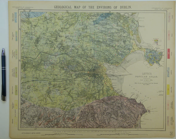
Dublin and environs, 1882. Letts.
Dublin and environs,, 1881. Scale 1"=1.3 miles. Colour print, slight off-setting of colour plate registration, 17.5"x14". Flat, non-standard colours. From Lett's Popular Atlas. Original margins narrow. In very good condition.
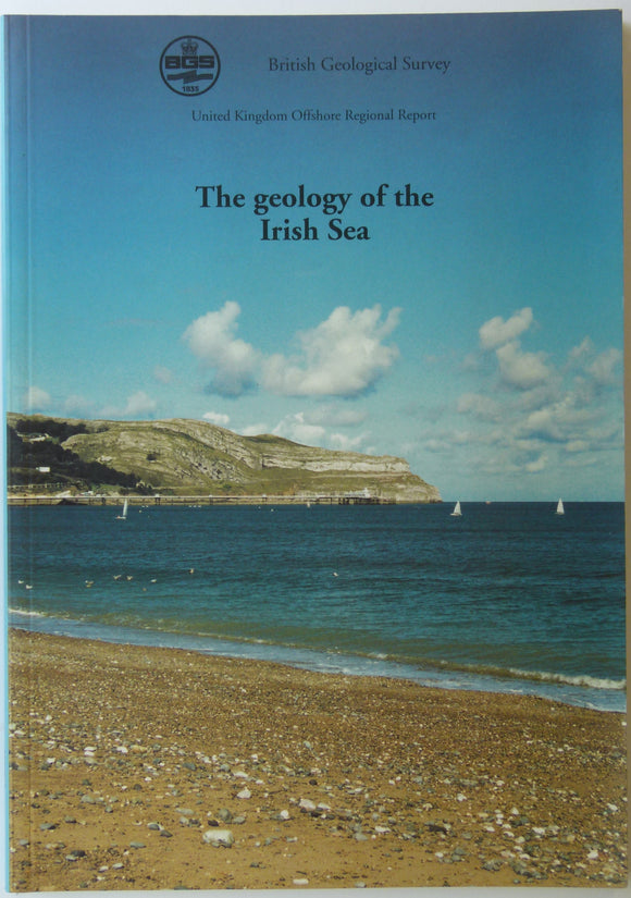
Memoir - Offshore. (1995). Jackson, DJ, et al. UK Offshore Regional Report; The Geology of the Irish Sea. 123pp. Paperback,. British Geological Survey.
Memoir - Offshore. (1995). Jackson, DJ, et al. UK Offshore Regional Report; The Geology of the Irish Sea. 123pp. Paperback, A4 report, clean, negligible wear. One of twelve reports supplementing...
Regular price £2000 £20.00
Section No. 9 (1861). Five sections covering Silvermines, Arra Mountains, Cratloe Mountains, Slieve Bernagh, Ennis. Hand-coloured engraving. Illustrates maps 132, 133, & 134. Geological Survey of Ireland.
Section No. 9 (1861).1. Across Keeper Hill to the Silvermines district, 2. From Ballyard Graveyard, across the Kilmastulla Valley, to the flanks of the Arra Mountains,.3. From Carrickallybaun, through Tomgrabey,...
Regular price £1900 £19.00
Ireland sheet 88, Longford, 1” scale. 1867. First edition. Covers Lanesborough. Base map undated. Hand-coloured. Geological Survey of Ireland.
Ireland sheet 88, Longford, 1” scale. 1867. First edition. Covers Lanesborough. Base map undated. Hand-coloured engraving, flat, 44.5 x 58.5cm. Linen-backed. Grommet in each corner. Colours bright, age-toned, brown glue-stain...
Ireland sheet 21, Larne, 1” scale. 1883. Covers to Lough Larne, 85% sea. Base map undated. Hand-coloured engraving, flat, 45 x 61cm, old folds very worn with old cloth tape...